Monday, September 28, 2009

Lessons Learned

Would we do the trip again?

It wasn't nearly as hard as we had feared it would be. We did get lucky with the weather. Cloudy is good. We didn't see much sun and most of the rain occurred at night. It doesn't get much better than that.

Some things we learned along the way:

Go east, young man. It is much easier to ride west to east than east to west. We could see that on the faces of the riders we met the day we rode down the east side of the Continental Divide.

Try to avoid Ohiopyle during a weekend or a holiday. We were there on a weekend and a holiday. Crazy.

Expect the unexpected. When the unexpected happens just go with it. One member of our group saw a deer in the canal who had just fallen off a cliff. That, my friend, was unexpected.

Even if you start on a tricycle in your backyard

chris, clare, mi, may 63


you can end up 322 miles down a bike path with a great feeling of accomplishment.

chris, mile 0, 9.11.09


Wear a helmet! Let me say that again, wear a helmet!! One of our group would have ended up with a cracked skull if he hadn't had been wearing one. Luckily it was the helmet that ended up with the crack in it.

We found 50 to 60 miles a day to be doable and enjoyable. It allowed plenty of time for sightseeing and numerous breaks.

This trip doesn't require extensive training. We had those that rode a lot of miles to get ready for this trip and some that rode just a few miles to prepare. All rode the entire 322 miles.

There is very limited cell phone coverage in many parts of the trail.

For those driving the sag wagon be forewarned: Dollar General was the highlight of one of the day's activities.

KOA's don't come with linens. Live and learn with that one.

I don't think riding the towpath in the fall is the best idea. We all agreed it would have been much harder to ride the towpath if the rocks, ruts and tree roots had been covered with leaves. Note the helmet warning.

Bill's in Little Orleans is a "must see". Don't forget to put a dollar on the ceiling.

Most importantly choose the people you are going to ride with wisely. We choose very wisely and ended up having a great time.

dave, chris, john, jack, towpath, 9.09


I will sum our trip up with a quote by Ernest Hemingway.

It is by riding a bicycle that you learn the contours of a country best, since you have to sweat up the hills and coast down them. Thus you remember them as they actually are, while in a motor car only a high hill impresses you, and you have no such accurate remembrance of country you have driven through as you gain by riding a bicycle.


Would we do it again?

In a heartbeat.

332 Miles Brought Us To Here

Day Six: Friday, Sept. 11, 2009

After 332 miles and six days we had come to this. The very beginning of the C & O Towpath.

mile 0, georgetown, 9.11.09


Rosy and I had been patiently waiting for over an hour to see this:

jack, mile 0, 9.11.09


It's Jack! They had made it. We're over here, boys! They all had made it and here they come!

jack, dave, chris, mile 0, 9.11.09


Jack sure does look happy. I bet he's glad Chris stopped him from riding back to Pittsburgh this morning.

jack, dave, john, chris, mile 0,9.11.09


One more bridge, boys. It's not the highest nor the longest bridge of the week but I'm sure it will be the most memorable one you cross during this trip.

mile 0, georgetown, 9.11.09


Pittsburgh

mckeesport, pa, 9.06.09


to D.C. I see a lot of happy faces.

jack, john, dave, chris, georgetown, 9.11.09


The official portrait.

jack, john, dave, chris, georgetown, 9.11.09


Contrary to what Rosy and I had been told earlier that morning, the guys hadn't encountered any rain. That twelve mile head start that morning had made all of the difference. They didn't run into rain but they did have to deal with the mud.

georgetown, 9.11.09


At least my brother isn't wearing his old man socks.

chris, 9.11.09


georgetown, 9.11.09


There was one more bit of business to attend to before their ride was official. When Rosy and I were at the visitor's center we had gotten some certificates commemorating their achievement. Since this trip was a celebration of Dave's fiftieth birthday and he was the one who put this whole trip together, we thought it only appropriate he hand out the certificates.

john, dave, chris, mile 0,9.11.09


Congratulations, Jack. Aren't you glad you aren't riding back to Pittsburgh right now? I have no words for my brother's face.

jack, john, dave, chris, 9.11.09


It's now official!

jack, john, dave, chris, 9.11.09


Once the congratulations were over and many photos taken it was time to head to Arlington. That could only mean one thing. Get out the maps.

chris, 9.11.09


rosy, john, dave, georgetown, 9.11.09


Jack decided to wash some of the mud of the morning off of his bike while the guys figured out how to get where they were going next. It's probably just as well.

jack, georgetown, 9.11.09


Congratulations, guys. Job well done. It was a trip of highs (standing on the Continental Divide) and lows (landing on one's head). It was a trip of the expected and the unexpected. It was a trip of old friends and newly made friends. Would we do it again? Stay tuned and find out.

to be continued...

Sunday, September 27, 2009

Talk To Me, Shirley!

Day Six: Friday, Sept. 11, 2009

Point of Rocks to Washington DC

Would you believe the day again dawned cloudy with the threat of rain? I'm beginning to see a pattern here.

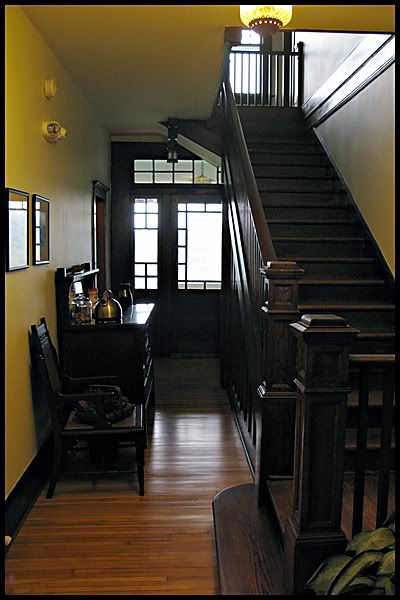
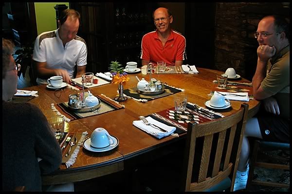
While the innkeeper Chris was preparing breakfast we took some time to explore Laurel Lodge.

Can you see why we liked it so much? Dave really liked the jar that was kept filled with cookies for guests.

Photobucket


Photobucket


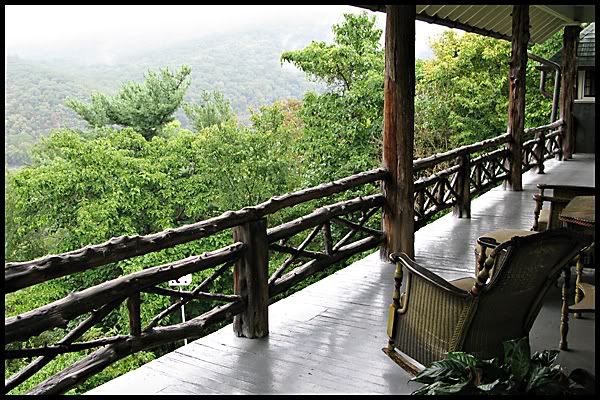
The view from the back porch was incredible. If you looked really close you could see the Potomac meandering through the valley. Because the house was situated on the edge of a hill/cliff it was almost like being in a treehouse. Do you think they would let me move in? I would bake cookies for the cookie jar in the foyer. I promise.

Photobucket


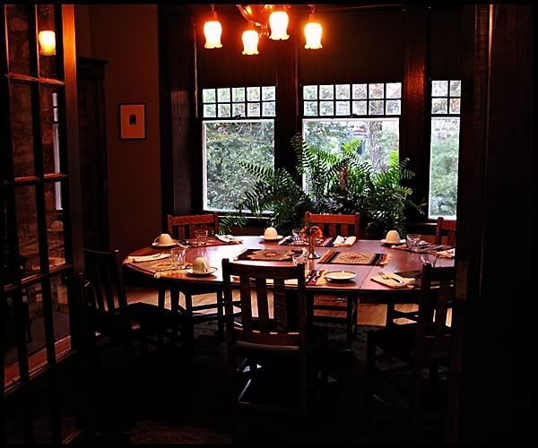
It was time for breakfast and it was well worth the wait. We even had two courses. That was one more course than any of the other places we had stayed at that week. I think we all agreed that this was the favorite B & B of the trip. Thanks, Laurel Lodge.

Photobucket


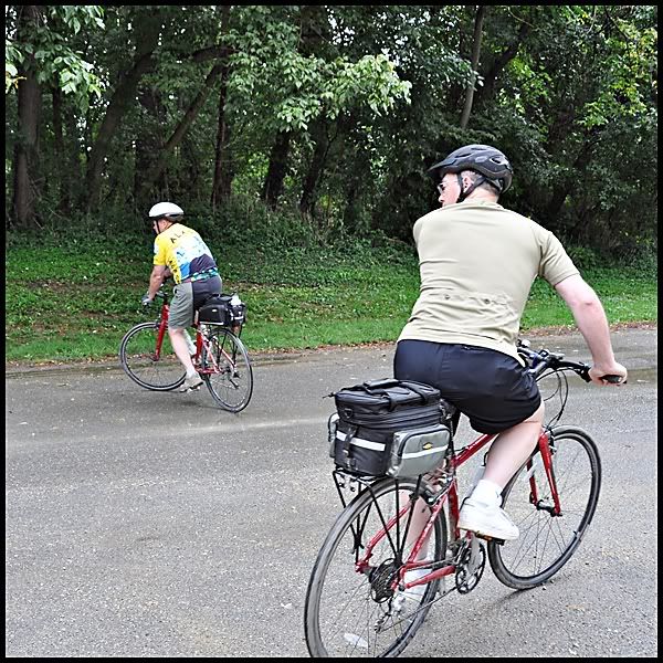
It was time to head for Point of Rocks. That morning, yesterday's decision to ride that extra 12 miles seemed like a very wise choice. If it rained the way it was threatening to that morning the ride today could be slow and muddy.

Are you tired of unloading bikes yet, Dave? I know I'm tired of watching.

Photobucket


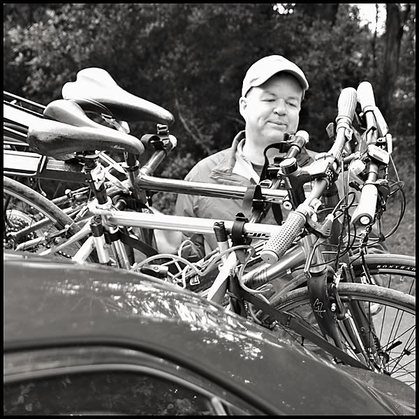
Some last minute adjusting was done.

Photobucket


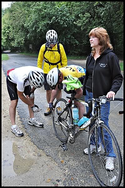
As the bikes were being unloaded and adjusted Chris was giving Rosy and I some last minute instructions. We were nervous about today's trip to DC. Until today we really hadn't seen much traffic and keeping two cars together had been relatively easy. But today would be a different story. Shirley, our GPS's, had been reliable. They didn't always agree on the same route but when my Shirley was forced to follow Rosy's Shirley my GPS had never failed to adjust. Chris said we would have to bear right two times but other than that it should be an easy drive into the city. I'm counting on you, brother, to be right about this. We don't need any surprises today.

Directions were given and bikes and riders were ready. It was DC or bust!

Photobucket


Hey, do you guys need a Shirley? There seems to be some confusion on which way you're going.

Photobucket


That way. Jack is going that way.
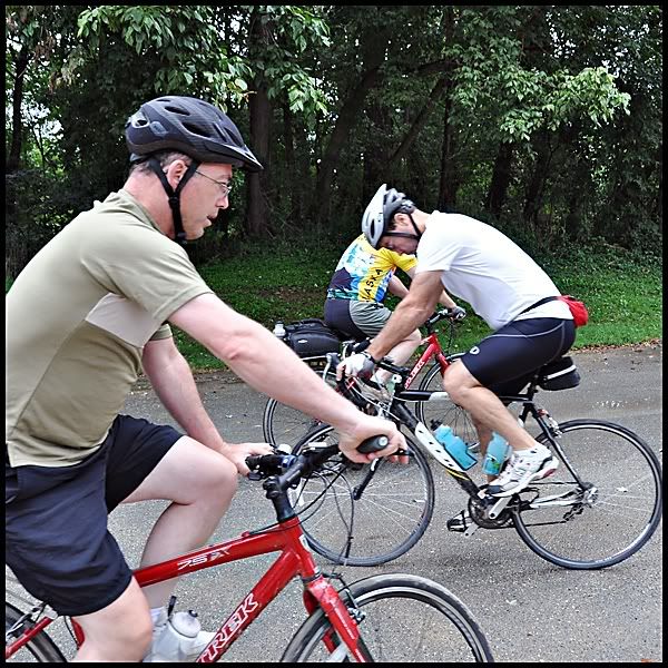
Photobucket


They're off!

Photobucket


Hold on. What's that, Chris? "We're going the wrong way. We're supposed to be heading in that direction." Someone better stop Jack or else he'll be in Pittsburgh before he knows it.

Photobucket


Looks like all of the guys are headed in the right direction so now it's time for Rosy and I to fire up our GPS's. It seems like there may be a problem. Both of our Shirleys are saying that there will be a toll road involved. Chris didn't say anything about toll roads. We both had I-Passes. But the question was did they work where we were going? We didn't know. My I-Pass has worked in Illinois, Indiana, Pennsylvania, New York, and soon-to-be Ohio. But here? We both agreed if for some reason we got separated we would just continue on by ourselves. We were sure we would both eventually end up where we were supposed to; The Hilton Garden Inn in Arlington. We were off. But, unlike the boys, we started out by going in the correct direction.

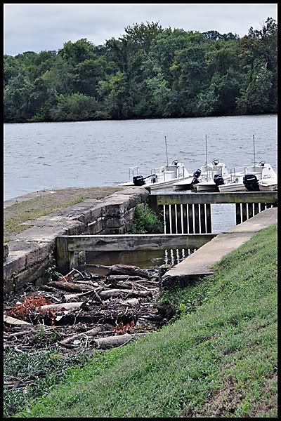
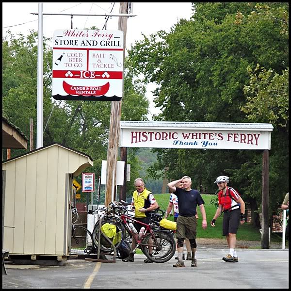
While we made our way to Arlington the boys were exploring White's Ferry. There used to be 100 ferries operating on the Potomac; this is the last one still in operation and is still quite busy. The guys in the photo had also started riding from Pittsburgh the same day we did. Periodically the guys had run into them on the trail. They would see them one more time this day near the end of the towpath.

whites ferry, 9.11.09


Rosy and I had made it to the tollbooth that Chris hadn't told us about. We had decided earlier that we would just go through the cash lane and if our I-Passes worked it would flag us through. As we got close to the toll booths I realized I didn't have exact change and couldn't follow behind Rosy who was in the exact change lane. No worries, I just got in the lane next to her. Or so I thought. When I came out of the other side of the tollbooth (our I-Passes did work) Rosy was nowhere to be seen. Okay. Just drive slow and she is sure to catch up. No Rosy and now I have come to a split in the road. Right? Left? I don't know. Talk to me, Shirley! No response. All I could think of was Chris saying you will always go right. So go right I did. When Shirley started to recalculate my route I knew I had chosen wrong. I didn't know it at the time but Rosy saw me driving off in the wrong direction but there was nothing she could do about it. I didn't have time to ponder my dilemma because I immediately faced another split in the road. Which way? Talk to me, Shirley! No answer so I choose right. She recalculated which means I had chosen wrong again. Thanks, brother. I had a beautiful drive into Arlington and without much trouble found the Hilton. As I circled around the block for the second time looking for the entrance who should drive through the intersection in front of me but Rosy! We both had made it. We found out later we had driven into Arlington from two different directions.

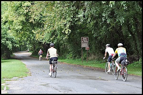
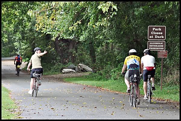
As we made our way to Georgetown to look for the end of the towpath the guys were making their way down the towpath. Their next sightseeing stop was Great Falls Park.

great falls, 9.11.09

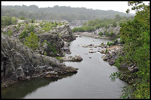
Many people consider the Great Falls of the Potomac to be the most spectacular natural landmark in the Washington D.C. metropolitan area. Here, the Potomac River builds up speed and force as it falls over a series of steep, jagged rocks and flows through the narrow Mather Gorge. This dramatic scene makes Great Falls Park, located just fifteen miles from the Nation's Capital, a popular site with local residents and tourists from around the world who are visiting the Washington area.

The falls consist of cascading rapids and several 20 foot waterfalls, with a total 76 foot drop in elevation over a distance of less than a mile. The Potomac River narrows from nearly 1000 feet, just above the falls, to between 60 and 100 feet wide as it rushes through Mather Gorge, a short distance below the falls. The Great Falls of the Potomac display the steepest and most spectacular fall line rapids of any eastern river.


great falls, 9.11.09


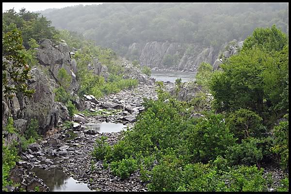
The guys were somewhat disappointed. The falls weren't falling. Chris had been there just a few weeks before and said the falls had been spectacular. This just means we'll have to go back.

The guys had one more bit of sightseeing to do and then it was the final push for the end. And what was that last bit of sightseeing? It seems this had reared its ugly head again.

the rock, towpath, 9.08.09


Yes, Dave hit another rock. This time he flew off sideways and landed in the bushes with his bike on top of him. His friends were useless because they were laughing too hard but some guy on his way to his fishing spot heard the commotion and came running to help. He pulled the bike off Dave and was the one who kept asking if he was okay. Is there anyone out there watching out for my husband? Laughing while he is laying in the bushes? I am shocked. I would have at least waited until he was back on his feet.

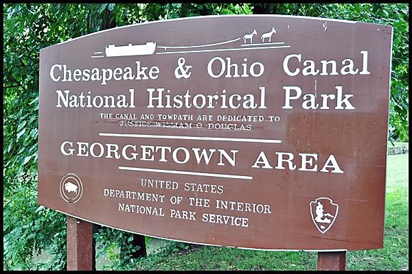
Meanwhile Rosy and I had found the towpath in Georgetown and were making out way toward the end. We kept counting down the locks knowing we had to get to Lock One. As we walked closer to the end we came upon this:

georgetown, md, 9.11.09


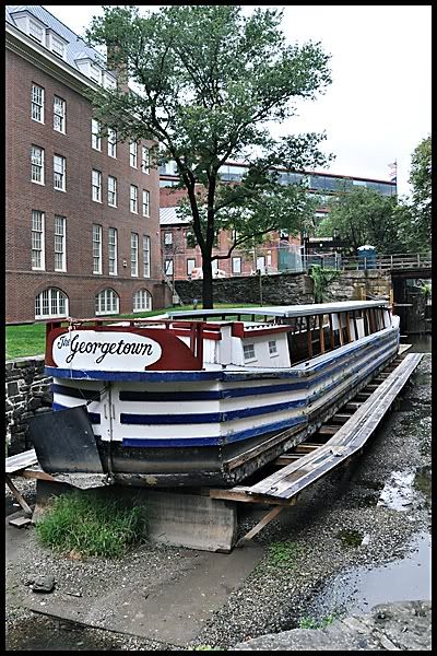
We found out later that at certain times of the year this boat is in operation. They even use mules to pull the boats just like they used to. Today, obviously, it wasn't in operation. Another reason to go back.

We walked just a little further and look what we found:

georgetown, md, 9.11.09


The end of the towpath! After 332 miles we had found the end. Now we just had to wait for the guys. As we walked back up the path we ran across two very muddy, wet guys with bikes. So we asked them, "Is this really the end of the towpath?" They assured us it was. They told us that they weren't riding the distance they did without going to the very end. They had started the day in Harpers Ferry and said that it had poured. We told them our guys had started 12 miles further down the trail and were hoping they had missed the rain. They assured us the guys were surely as soaked as they were.

When we saw the guys later that afternoon we asked the how wet they had gotten. They hadn't. They had managed to avoid the rain the entire day.

As we continued on my cell phone rang. We had service and it was Dave. I excitedly told Dave we had found the end of the towpath and were waiting for them. "Do you see the stone monument with a zero on it?" Noooo. We have a problem. We weren't at the end. What to do? There were no signs directly us from that spot. Luckily Rosy had remembered seeing a visitor's center so we made our way there. The girl in the center confirmed what Dave had told me. We hadn't found the end. We got directions and continued on our way. I have to say this was very poorly marked. There was nothing to indicate where to go. After crossing roads, under bridges, through a park, a shopping area and around and behind a boathouse we finally found our final destination. We needed Shirley. Those poor guys we had met earlier. They never did know that they hadn't biked the towpath to the very end. Maybe it's just as well.

We called the guys and gave them the directions as best we could and settled in to wait. We would spend an hour standing and watching from this spot. We weren't going to take a chance of missing their grand entrance.

end of towpath, georgetown, md, 9.11.09

Saturday, September 26, 2009

A Change In Plans

Day Five: Thursday, Sept. 10, 2009

Rosy and I had done some shopping, sightseeing and had decided we should make our way to the towpath and wait for the boys. The towpath was located on the other side of the Potomac so we made our way over the bridge. The bridge is located where the Potomac and Shenandoah Rivers converge and makes for a really pretty view.

harpers ferry, wv, 9.10.09


Here, the forces of nature created a natural corridor for commerce. The Shenandoah and Potomac Rivers carved a notch in the mountains, providing passage west. Communities grew up on both sides of the river and later a turnpike, railroad, and canal came through this notch. The railroad and canal competed constantly until the railroad gained dominance. Because of the devastation of the Civil War and decreasing dependence on waterpower the area declined in importance.

harpers ferry, wv, 9.10.09


Not only do rivers converge and the railroad and canal compete for space but the Appalachian Trial also makes an appearance at this spot. For a short distance the towpath and Appalachian Trail run together. There is a lot happening in this one spot on the towpath.

While we were exploring this area the boys were taking in the sights along the towpath.

chris, towpath, 9.10.09


They're here! Good because it's late and I'm getting hungry.

jack and john, harpers ferry, wv, 9.10.09


dave & chris, harpers ferry, wv, 9.10.09


While we were standing there sharing our morning adventures one of the gang looked up and spotted this flying overhead.

eagle, harpers ferry, 9.10.09


Do you know what it is? Here is a closer look.

eagle, harpers ferry, 9.10.09


If you guessed an eagle with his lunch then you would be correct. Speaking of lunch it was time for ours.

While we enjoyed our lunch in town we decided to make a change of plans. The weather wasn't looking good for the next day and it was already quite late in afternoon. We really weren't going to have time to do Antietam Battlefield justice. It was decided that the guys would ride 12 more miles down the towpath to Point of Rocks. This would give them a head start on tomorrow's ride which if wet and muddy would be slow going. In retrospect this turned out to be a wise decision.

After lunch the boys made their way to the towpath

john, jack, chris, harpers ferry, 9.10.09


and Rosy and I did a little more shopping before heading back up the hill to Laurel Lodge and our cars.

The boys also did a little sightseeing as they made their way to Point of Rocks. The major point of interest of the afternoon was the Catoctin Creek Aqueduct.

The Catoctin Aqueduct is an historic canal structure of great importance to the transportation, structural, cultural and social fabric of Frederick County, the Village of Lander, the C&O Canal, the State of Maryland and our nation. The Catoctin Aqueduct site is where the C&O Canal and B&O Railroad, two arch rivals, first competed to concurrently cross a major tributary of the Potomac River– Catoctin Creek. It’s one of 11 stone aqueducts on the 184-mile long C&O canal.

towpath, 9.10.09


In October 1973, after over fifty years of neglect and repeated ravishment by storms and floods, the 139 year-old aqueduct collapsed into Catoctin Creek. Since 1978 an unsightly, yet functional, WWII-era steel frame Army Bailey bridge has temporarily spanned Catoctin Creek to convey hiker/biker traffic over the creek. The remains of the Catoctin Aqueduct are scattered under this "temporary" bridge–deteriorating and unnoticed.

towpath, 9.10.09


Of course, photos had to be taken.

jack, towpath, 9.10.09


chris, towpath, 9.10.09


Eventually we all made it to Point of Rocks though it wasn't easy. Luckily Chris spotted us driving around the Amtrak parking lot looking lost. We just didn't look lost we were lost. I wish they could mark some of these trailheads better than they do. We would have never found this one on our own. To find this trailhead one had to go down a dirt road next to the train tracks, cross over the tracks, drive over a one lane bridge and hang a right into a small dirt parking lot. Like I said we were lucky that Chris happened to spot us in the Amtrak parking lot or else we would still be driving around in circles.

We headed back to the inn, cleaned up and walked to a local restaurant and enjoyed a lovely dinner.

Today's distance by bike: 48 miles

Tomorrow was the day. It was DC or bust. Would everyone make it? Could Rosy and I navigate DC traffic with two cars and end up in the same place? Would a rock rear its ugly head again? All that and more in the next installment.

to be continued......

About Me

My photo
I'm strange, but I've got a great sister!

Newton's Cradle